FISHING EQUIPMENTS
SATELLITE BUOY
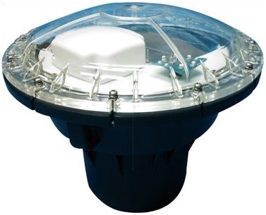
Buoy: SV-6000L type 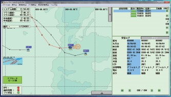
Ship station: Example of display of buoy and Schooling fish information on chart |
|
The satellite buoy (Marinestar) is a new buoy positioning and tracking information system
that can display the position of the buoy in an electronic chart by the pinpoint, and promote the efficiency improvement of the fishery. |
Buoy | SV-6000L model Satellite buoy |
|---|---|
Ship station | SV-SC5000 model complete set (PC, buoy management chart with software) |
|
Information on the buoy and the operation command from Ships Bureau are communicated via INMARSAT satellite → earth station → INMARSAT satellite. 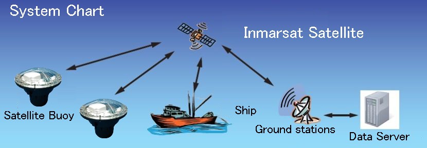
|
|
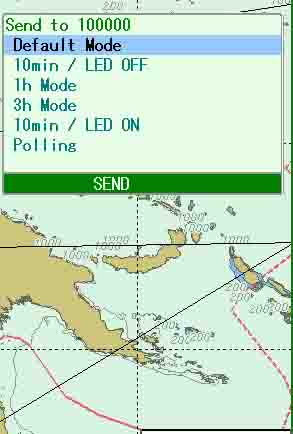
Two position data as the default is the factory setting. |
 |
|
The interval of the transmission of the position data of the buoy is automatically changed according to the distance with the fishing vessel. 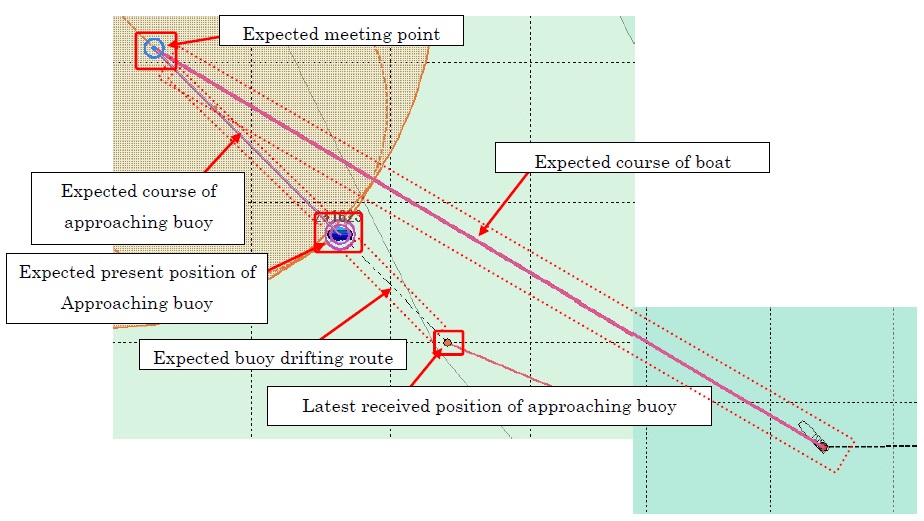
|
|
The Position data of the final acquisition is displayed in the red circle, present location is forecast, and it displays it with the buoy icon. |
|
Tracks of the buoy can be delimited by the period. |
Product catalog |
SV-6000L Type |
|---|